Brisbane River
From its headwaters near Mount Stanley, east of Kingaroy, where its East and West Branches merge, southeast Queensland's River travels 344 kilometres through the state capital before discharging into Moreton Bay. John Oxley explored the river after New South Wales' Governor Sir Thomas Brisbane in 1823. He suggested a site somewhere on its lower reaches would be a better option than the Redcliffe Peninsula for the new penal settlement at Moreton Bay. Oxley, a naval officer, reputedly favoured a location on the river's Milton Reach. The army officer in charge of the party that established the settlement, opted for the rectangular location with water on three sides that now constitutes Brisbane's CBD.
Once the settlement had been established, the Brisbane River remained the main transport route between Brisbane and Ipswich until the two centres were linked by rail in 1875.
Wetlands associated with the tidal estuary —the water is brackish as far upstream as the Mount Crosby Weir — and the river's meandering course presented a significant obstacle to the first Europeans known to have traversed the area. Three timbergetters from Sydney who had been bound for the Illawarra — Thomas Pamphlett, John Finnegan and Richard Parsons — were cast ashore on Moreton Island on 16 April 1823, crossed to the mainland and spent a month making their way upstream before they found a means to cross the river. None of the trio could swim. While they were living off the land, gathering fern roots as they went and there is no indication of where they encountered the stream, their crossing point — Oxley Creek, where they found a canoe — is about twenty-six kilometres from the river's mouth as the crow flies and seventy kilometres as the brown snake winds.
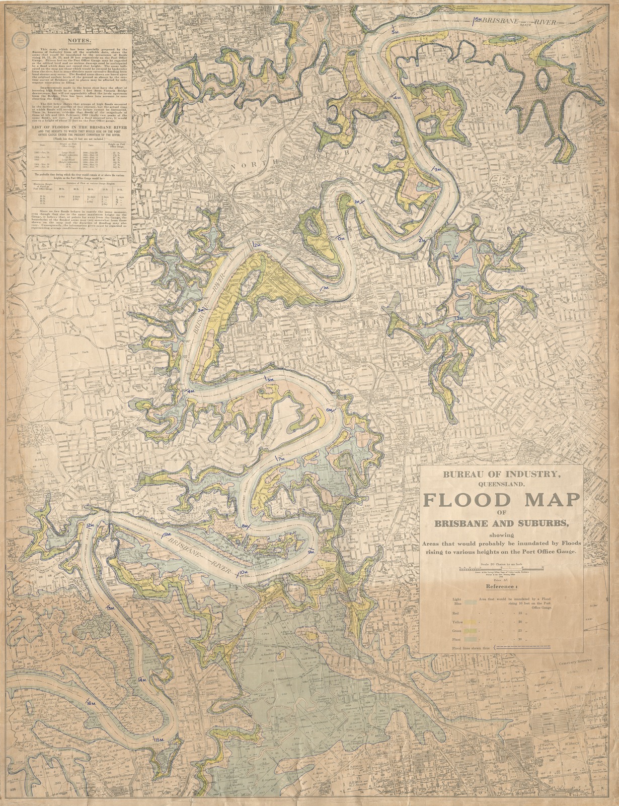
While those wetlands have long been covered by suburban development, they emerge as a significant factor when the river floods. Runoff from residential developments, prevented from flowing away by the swollen stream, backs up, flooding areas well away from the stream itself. Multiple major floods, including those of 1893, 1974, January 2011 and February 2022, submerged Oxley's preferred site for the convict settlement on the reach the Turrbasl people called Maiwar.