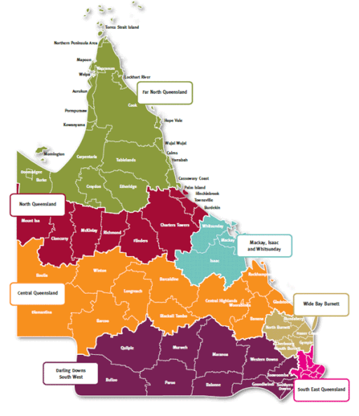
Far North Queensland
The northernmost section of the Australian mainland, Far North Queensland (FNQ), incorporating Cape York Peninsula, the Gulf Country and Torres Strait, officially includes:
- Twenty-five Local Government Areas, among the administrations listed here;
- Three World Heritage Sites — the Great Barrier Reef, the Wet Tropics and Riversleigh;
- Over seventy national parks, some of which are listed here.
Prior to European settlement, the region was inhabited by numerous First Nations groups, listed and cross-indexed in What Mob is That?
While different government departments and agencies define the region differently, this site uses the 2016 Queensland Government Department of Trade and Investment definition, encompassing the following local government areas; Aurukun, Burke, Cairns, Carpentaria, Cassowary Coast, Cook, Croydon, Doomadgee, Douglas, Etheridge, Hope Vale, Kowanyama, Lockhart River, Mapoon, Mareeba, Mornington, Napranum, Northern Peninsula Area, Pormpuraaw, Tablelands, Torres Strait Islands, Weipa, Wujal Wujal, Yarrabah and the various autonomous Torres Strait Islands.