Great Australian Bight
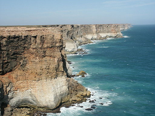
The Great Australian Bight, with its distinctive coastline of towering cliff faces and rugged capes, spans the central and western stretches of Australia's southern coastline. It straddles South Australia and Western Australia, with the Eyre Highway skirting the bight's cliffs between the Head of the Bight and Eucla.
Formed around fifty million years ago when Australia separated from Antarctica as Gondwana broke apart, separating Antarctica from Australia, the Bight was first encountered by European navigators when François Thijssen and Peter Nuyts, charted 1800 kilometres of ‘Nuyt’s Land’ between Cape Leeuwin and Nuyts Archipelago in the Gulden Zeepaard in 1627. Matthew Flinders delivered a more detailed chart on his circumnavigation of Australia in 1802. Edward John Eyre carried out a later land-based survey in 1840-41.
Because the Bight's biodiverse waters have immense ecological significance, proposals to explore the seabed for oil and gas resources since the 1960s have sparked significant opposition due to the potential environmental impacts.
Missing links:
Gondwana