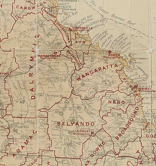
Wangaratta Division/Shire
Created as a local government division in 1879, Wangaratta Shire covered an area of over 21,000 square kilometres when it was merged with the Bowen Town Council to form the Bowen Shire in 1960. The shire took its name from a minor waterway, Wangaratta Creek, which shared its name with a settlement later renamed Bobawaba.
Although the shire's natural advantages — grasslands suited to grazing cattle, fertile river flats along the Don and Elliot Rivers, Collinsville coal, and the best harbour on the Northern coast at Bowen — might have seen the area prosper, a combination of circumstances and regional competitors meant they were never fully exploited.
While a railway line from Bowen to Bobawaba opened in 1891, that was as far as it went for twenty years due to arguments over the next stage. Bowen interests wanted the line to cross the Burdekin and link to the western line from Townsville to Charters Towers. Competing interests in Townsville and Ayr wanted it to follow the original route, crossing the river lower down and eventually won the day. The line was extended to Home Hill and Ayr in 1913.