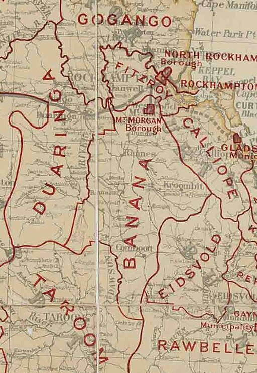
Banana Shire
Located inland from Gladstone, Banana Shire is named after the first township in the region, which took its name from the burial site of a huge dun coloured bullock named 'Banana'. The council sits in Biloela, the Shire's largest town.
Originally one of the 74 Divisions established under the Divisional Boards Act 1879, the Shire’s boundaries and administrative centres evolved over time. Initially, Banana served as the centre, followed by Rannes in 1930 and finally Biloela in 1946.
The original Division was split in April 1881, creating the Duaringa Division. Further changes occurred in 2007 when the Local Government (Reform Implementation) Act saw Banana Shire absorb the northern part of the neighbouring Taroom Shire, including the town of Taroom. Consequently, Taroom Shire’s southern portion merged into the Dalby Region, which was later renamed the Western Downs Region.
The Shire of Banana includes the following settlements:
Banana area:
Alberta
Banana
Baralaba
Baroondah
Biloela
Broadmere
Callide
Camboon
Castle Creek
Cockatoo
Coorada
Cracow
Dakenba
Deeford
Dixalea
Dululu
Dumgree
Dumpy Creek
Eurombah (shared with the Western Downs Region)
Glebe
Glenmoral
Goovigen
Hornet Bank
Isla
Jambin
Kianga
Kinnoul
Kokotungo
Lawgi Dawes
Lonesome Creek
Mount Murchison
Moura
Orange Creek
Peek-a-doo
Pheasant Creek
Prospect
Rannes
Roundstone
Spring Creek
Tarramba
Thangool
Theodore
Ulogie
Valentine Plains
Warnoah
Westwood
Woolein
Wowan
North Taroom area:
Ghinghinda
Glenhaughton
Gwambegwine
Taroom
Sources:
- Wikipedia: Shire of Banana